


shared spaces for blind and partially sighted people: a challenge for designers
issues and advice for accessible public spaces
Authors
Drs. Else M. Havik and Dr. Bart J. M. Melis-Dankers
Royal Dutch Visio, Center of Expertise for Blind and partially sighted people. Huizen, the Netherlands.
Translation and revision by Prof. dr. Helen Petrie, University of York, Department of Computer Science. York, United Kingdom.
executive summary
Shared Space for visually impaired people: a challenge for designers. Focus points to achieve accessibility.
This focus point guide is the result of the research project "Accessibility of Shared Space for visually impaired people" that was conducted between 2009 and 2012 at Royal Dutch Visio, Centre of Expertise for Blind and Partially Sighted People. The Knowledge Centre Shared Space and the Accessibility Service of Royal Dutch Visio [Visio Zicht op Toegankelijkheid] were closely involved in the realisation of this guide.
Shared Space is a concept for the planning, design and use of public spaces. With respect to environmental design, it aims to create a streetscape that emphasizes the presence of human activities, thereby stimulating road users to behave cautiously and socially. Research by Visio has shown that in areas that are designed in conformity with the Shared Space concept, accessibility for visually impaired people is significantly lower than in conventionally designed areas.
The challenge for designers of Shared Space is to gain an understanding of those elements that are necessary to make the environment accessible for blind and partially sighted people and to integrate these elements in a Shared Space design without violating the concept as such. This guide aims to provide designer with the information that is required to achieve this.
The guide organizes information gained from research, from expertise on orientation and mobility for blind and partially people and from existing Dutch guidelines on accessible design. It starts by explaining how visually impaired people use environmental elements for the purpose of orientation and navigation (part A) and discussing the basic starting points both for Shared Space design and for designing for visually impaired people (part B). It then lists the most important functions that a Shared Space design should facilitate and describes the aspects that are important for visually impaired people (part C), and provides information about several design elements that can be used to increase accessibility for visually impaired people (part D). Finally, there is a checklist with the most important focus points that are mentioned throughout the text.
The guide is of interest to designers and others who are actively involved in the design and planning of Shared Space areas. It is meant to serve as a starting point to be used in the earliest design and planning stages. However, the final realization and integration of the focus points provided, used appropriately and in relation to the specific environment, requires more knowledge than can be offered in this guide. We therefore strongly recommend having the preliminary design checked by an expert in the field of accessibility for visually impaired people. For this we refer to the Accessibility Service of Visio. For more information about Shared Space we refer to www.nhl.nl/sharedspace.
introduction
Shared Space is a concept for the design and use of public spaces, in which the road user is made aware of the presence of human activity by the design of the road. Research by Centre of Expertise for Blind and Partially Sighted People, Royal Dutch Visio, has shown that areas that have been designed based on the Shared Space concept are less accessible for people with visual impairments than conventionally designed environments. The lack of conventional structure (e.g. curbs and crossings) can lead to problems with orientation and way finding for visually impaired people. Teaching safe and familiar routes is difficult in Shared Spaces and visually impaired people feel less at ease.
Challenge for designers
At first sight the principles of Shared Space seem difficult to combine with the demands that are placed on an accessible space. The challenge for designers is to incorporate the essential elements for visually impaired people in the design of a public space, without violating the Shared Space concept.
Purpose of this guide
 General awareness of the specific requirements for visually impaired people for accessible spaces by providing background information and guidelines.
Application of this information and guidelines from the early stages of the planning and design process will result in comfortable and pleasant spaces for people with visual impairments in future Shared Space areas.
Contents of the guide
Elements to be taken into account when designing accessible Shared Space for blind and partially sighted people are listed and explained.
Part of this information is taken from existing sources (see bibliography). Where applicable, these sources are referred to [in square brackets]
We have deliberately chosen to be very sparing with illustrations and photographs in this guide. This gives designers the opportunity to come up with their own solutions for each of the guidelines.
In cooperation with Visio, the Knowledge Centre Shared Space of the Noordelijke Hogeschool Leeuwarden (NHL) developed an online database with information, tips and guidelines, which also provides examples of Shared Space design. We urge you to upload your own examples here. This database can be accessed through the website of the NHL and the website of Visio.
Intended use of this guide
The guide is intended for anyone involved in the planning and designing of a Shared Space location.
From the very first stage in the planning and design process one should take into account accessibility for blind and partially sighted people. The focus points in this guide can be used as the basis for this process.
We emphasize that more knowledge is needed for the final resolution of the issues than can be offered in this guide. One needs to bear in mind that applying the guidelines will not automatically lead to an accessible design. The separate details are only applicable when they are used in conjunction with each other. In addition, proper application of the points depends very much on local conditions. Once the preliminary design is complete, it is important to review the design and to seek advice from an expert in the field of accessibility for visually impaired people.
The advisory service Royal Dutch Visio has expertise in this area and can help you. Through close cooperation with our project partners you will be redirected to a specific expert in your various areas of interest.
The information in this guide on visual accessibility of public places is often also applicable to public places which are not specifically Shared Space.
contents and structure
Brief background on visual impairments and their consequences for mobility and street design. This chapter is important to understand the focus points in this guide.
A3
A4
General principles which form the basis for the rest of this guide and make clear what the challenge is for designers of a Shared Space area.
Important features that should be facilitated in a public space. The relevant elements for visually impaired people are discussed per function. For further detail we refer to section D.
C2
C3
Design elements that can be used to guarantee accessibility for people with visual impairments.
D2
Overview of the major concerns.
Additional information about the recommended procedure to achieve optimal accessibility of the Shared Space environment. This takes into account the different audiences and advisory disciplines.
List of major works of reference in the text referenced by numbers [in square brackets] and tips for further reading.
visual impairments
In the Netherlands, more than 316,000 people are blind or partially sighted. It is expected that this number will increase by 20% to 380,000 in 2020 [1]. This is a significant part of the population which cannot be ignored.
The majority of these people are aged fifty years or older.
Only some people with a visual impairment are blind. Blindness is defined as no light perception at all, or if only light and dark can be distinguished, or if visual acuity (a measure of the perception of detail) is less than 20/400 and/or the field of view is limited to less than 10 degrees (a full field of view covers approximately 180 degrees).
The majority of people with visual impairments have low vision. They can use their residual vision to some extent. There are many different types of visual impairment, each with its own specific effect on mobility.
1
Various visual impairments
In addition to visual acuity and visual field, other aspects of vision may be affected, such as light perception, contrast sensitivity or colour vision.
The pictures on page A1 give some examples of what people with different visual impairments can see.
These different forms of visual impairment may have very different consequences for the ability to move around independently.
These differences should be taken into account in the design. Accessibility Service of Royal Dutch Visio can provide information about the specific effects of certain eye conditions.
1

Photo of a Shared Space area in Haren, made with Low Vision Simulator. The images are simulations of (from left to right): visual acuity 20/2000; acuity 20/40 with central loss; acuity 20/40 due to glaucoma, normal visual acuity 20/20 with peripheral field loss due to Retinitis Pigmentosa. These images give a global impression of what people who have these types of visual impairment see.
1
Low Vision Simulator
With the Low Vision Simulator pictures of random situations can be modified so that they give an impression of what someone who is visually impaired can or can not see. The software for the Low Vision Simulator can be downloaded free of charge from http://www.visio.org/kennis-expertise/projecten/low-vision-simulator.
The simulations can serve as a tool for designers to get an impression of the accessibility of their design for someone with a particular visual impairment.
Other simulation programs are mentioned in D1.
1
mobility and orientation
From A to B
For blind as well as for partially sighted people, a safe and easy transfer from location A to location B is not obvious.
In order to not collide with obstacles they have to be noticed in sufficient time. One has to be able to orient in space and to determine one’s location, in which direction one is moving and to know where to walk to. In addition, one must be able to recognize a safe route.
This is accomplished through usable residual vision (what can still be seen) and based on information obtained through the other senses.
2
Orientation and mobility training
Some blind and partially sighted people take orientation and mobility training to learn how to use their residual visual information and non-visual (tactile, audible, usable) information from the environment to move about safely and to orientate themselves.
During orientation and mobility training people usually learn fixed routes in familiar environments. These routes are learned by rote, on the basis of a sequence of points of orientation/interest. This requires a lot of practice and for most blind and partially sighted people, it is not an easy task.
In an unfamiliar environment, where one does not know the route, moving aroud independently requires a high degree of skills and independence in orientation and mobility. Predictability of the environment based on what one is used to, is important.
It should not be assumed that all people with visual impairments are fully independent. Even after training, they remain dependent on an accessible space.
2
The guide dog
A guide dog is trained to lead his or her owner around obstacles, to choose the safest route and to indicate learned landmarks on a route.
The dog has learned to walk on the sidewalk and uses the curb, marked by a difference in height, as a landmark.
In general, the dog is unable to make use of differences in colour or subtle differences in the texture or contrast of the paving material.
It is a misconception that a guide dog knows the way and can indicate when the owner can safely cross a road. In all circumstances, this remains the responsibility of the visually impaired person themselves.
3
Identification cane / Symbol cane
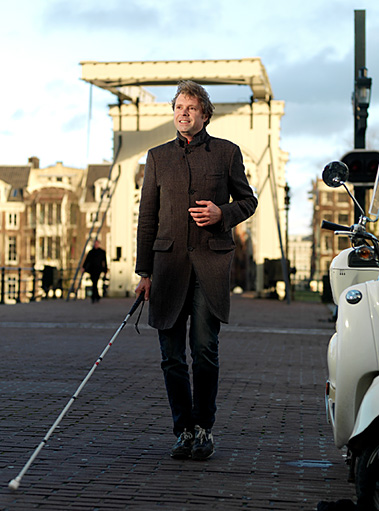
By far the largest number of visually impaired people do not use a long cane or guide dog. Therefore they are simply not recognizable as being visually impaired. Sometimes they carry a short identification cane, for example when crossing a road, so that is should be clear to other road users that they are visually impaired.
Electronic tools for obstacle detection and orientation
There are various electronic devices that, like a long cane or a guide dog, are capable of detecting obstacles.
In addition, there are electronic devices for navigation and orientation. These often use the Global Positioning System (GPS) and can provide assistance in locating and way finding.
GPS devices are not yet accurate enough to indicate whether one is walking on the pavement or the roadway.
3
landmarks
Landmarks are distinctive, recognizable elements in the environment. Such points represent confirmation of one’s location and can be associated with a particular act: after this I have to turn right, or here I have to cross. Sighted people mainly use visual information for theses task. However, blind and partially people largely or totally depend on information collected using their other senses.
4
Some non-visual landmarks
Changes in the surface that can be observed with a long cane or one’s feet. For example, a curb, a slope, a change in pavement material.
The sound of traffic. One can hear that one is approaching a side street. From the sound of the traffic flow someone can get information about the direction in which it is heading.
The smell of a particular store or restaurant.
Feeling the wind or the sun gives information about the presence of buildings or a side street and assists orientation.
4
Echo localization for orientation
Information about the environment, such as the height and width ratio of the street, can be derived from the reflection of the sound of a long cane or the contact of one’s foot with the ground. In this way one notices that a building is close by, or that a building line ends. This technique is called echo localization. Someone can use the sound from tapping their long cane or someone can produce a sound for this very purpose, for example, by a click of the tongue.
Certainly not all blind and partially sighted people are skilled in this technique. Learning to recognize and use such information from the environment requires a lot of explanation, training and practice. One should not assume that all people with a visual impairment have or can master this technique.
The guide dog and landmarks
A guide dog can learn to identify landmarks and common situations such as a pedestrian crossing, a curb or a mailbox on a route.
A dog does not have useful colour vision.
4
shared space design
A Shared Space design gives the street a different character to conventional designed areas. The aim is for the street to be used in a more social way.
The residential and social meeting functions of the space is emphasized. The design should cue drivers to be alert and provoke cautious behaviour, such as driving at a low speed and paying extra attention to other road users.
Usually (but not always) the usual structure of the road is minimized in Shared Space and lacks formal crossings, traffic lights and the traditional division into separate driving lanes for cars, bikes and pedestrians.
The space itself provides less formal indications of how traffic should behave. The traffic behaviour is thus more dependent on social rules and consideration for other road users.
1
The way a Shared Space environment looks is not uniquely defined. In general, the following principles apply:
 focus is on the residential nature and the social meeting function of an environment
free use of the environment, and sharing space is encouraged
focus is on pedestrians
motorized traffic is less dominant and has to behave as a ‘guest’
pedestrians, cyclists and motorized traffic are (partially) mixed
the indication of the boundaries between sections of the road meant for pedestrians and areas for motorized traffic and cyclists is less clear
the character of the space encourages social behaviour
users/residents are actively involved in the design
Applying Shared Space is not a goal in itself. It is only applicable where the environment permits it and users wish it [2].
For more information about the Shared Space concept we refer readers to the website of the Knowledge Center Shared Space: www.nhl.nl/sharedspace.
1
designing for people with visual impairments
Clear and recognizable structure
For people with visual impairments, it is important that the area is sufficiently recognizable, so that they can move around in a safe and comfortable way. A clear and simple structure should ensure that the user immediately understands what is a good place to walk or to cross. This structure should be provided by means of elements that are clearly recognizable for blind and partially sighted people (see D1).
Consistency and predictability
For all users, but especially for people with visual impairments, it is important that street elements are used consistently and have the same meaning in different places in an environment.
2
Free usage and recognition - the challenge for Shared Space Design
Although visually impaired people need clear structure, Shared Space design specifically encourages people to share the space and to move freely through space. The designer of a Shared Space area is thus faced with the challenge to emphasize the individuality and the residential character of the area, and at the same time create enough recognizable elements and structures so that all road users, including people with visual impairments, know what is expected of them and how they can move through the area safely.
2
sharing spaces
Sharing space is a choice
A Shared Space area offers pedestrians the freedom to move freely through the area and to share it with the other road users.
Not all areas have to be shared. Pedestrians should be able to choose whether or not they interfere with other traffic.
Natural distribution of the space
Generally pedestrians walk along the side of the road and other traffic moves in the centre. This will also be the case in a Shared Space area.
Sharing the space mainly takes place on the roadway portion of the street, while the space along the sides is mainly intended for pedestrians and vulnerable road users.
1
Comfort zone [2]
It may be necessary to preserve this natural division explicitly in the design by means of a comfort zone where pedestrians and other vulnerable road users are given space and where no other traffic will be expected.
Especially in crowded situations, without a clear guiding line (see D2), the presence of a comfort zone is important.
The comfort zone is a continuous, barrier-free and recognizable route (see C3) between crossings and decision points.
For example, a comfort zone can be achieved by using different colours and materials, and by the installation of street furniture (see D1 and D4).
1
walking
Each destination should be accessible
For anyone who wants to do so it is possible to move through the area and to choose the shortest route from A to B even if one crosses the street diagonally. However, every possible destination (shop, café, home, office) should also be accessible via an accessible route.
Every conceivable connection must therefore be made accessible by at least one recognizable, barrier-free and uninterrupted route. A good connection of trails at crossings is necessary (see C3).
Good routing can be designed by using grid patterns (see D4).
2
General considerations for walking routes [3]
Sufficient free width (generally ≥ 1.8 m; occasional ≥ 1.2 m)
Sufficient free height (anywhere ≥ 2.3 m)
Even and sufficiently rough surface (level difference/bump no greater than 5 mm)
Free walking route
The route is free from obstructions (e.g. displays, terraces, street furniture, parked cars and bicycles).
To ensure a free walking route, there is a clear policy that is enforced.
2
Route guidance
Most people with visual impairments need clear guidance to keep moving in a particular direction and not to stray from the chosen route.
Route guidance is provided by natural guiding lines or tactile paving (see D2).
Route guidance is provided in a consistent manner throughout the entire location (see B2).
Borders of the pedestrian area (or comfort zone, see C1)
The comfort zone is bounded in a recognizable way for visually impaired people (see D3), so they can not end up in a part of the street where (motorised) vehicles drive without noticing.
This delimitation is carried out in a consistent manner over the entire location (see B2).
2
crossing
A place to cross in a Shared Space area?
Although a Shared Space area offers the freedom to cross the street everywhere, there are also users who benefit from a specially designated crossing place. This need not necessarily be a formal place with traffic lights, audible indications and/or a pedestrian crossing, for which special directives exist [3]. The considerations set out below yield a suitable crossing place for people with visual impairments.
Recognition and marking the crossing
The crossing place is clearly recognizable for blind and partially sighted people. For example, by a striking landmark (see A4).
3
For visually impaired pedestrians it should be clear where the crossing begins and when the other side is reached. The transition from pedestrian area to the section of the street with faster traffic is clearly felt by a long cane or underfoot (see D1: materials, and D5: warning marks).
A tactile marker in the direction of the crossing, where traditionally the curb would have been, is useful to visually impaired people to position themselves perpendicular to the driving direction and to cross in a short, straight line.
3
Recognition for other traffic
While drivers of vehicles and cyclists in a Shared Space area should always be alert to pedestrians crossing, the special crossing place should be clear.
To draw the attention of the other traffic to the crossing, a portion of the road can be marked by differences in colour and/or material or by a small gradient. Local narrowing of the road can lead to slower speeds and increased attention of drivers and cyclists.
Connection to the walking route
The area is designed in such way that the walkways automatically connect to the crossing place. This can be realized by a tactile marking (see D1: materials) perpendicular to the route and leading to the crossing.
3
parking, loading and unloading
At the start of the design phase one should make a clear choice on parking policy. One should weigh up whether the street offers plenty of space for parking spaces [2]. Sufficient space for the road users should always be available.
Lack of an unambiguous parking policy leads to chaotic and unpredictable situations. Good predictability is very important for people with visual impairment. Therefore, parking regulations should be clear and enforced.
Parking spaces should be located where the parked cars cannot interfere with sight lines for crossing places: not close to pedestrian crossings and intersections.
Carefully chosen placement of street furniture prevents parking on walking routes.
Parking places for bicycles should be included in the design. The same considerations for these apply as for vehicle parking.
4
displays and terraces
Because the walking route should remain free of obstacles, a clear policy regarding shop displays and terraces should be consistently implemented and maintained.
A walking route along a façade line requires that displays and terraces are arranged in such a way that sufficient walking space is left. The façade is free of obstacles and forms a continuous line where possible (see D2: natural guiding lines).
In cases where displays and terraces are close to the façade line, there is clear route guidance along the street side of the route that prevents blind and partially sighted people from straying out of the safe pedestrian zone onto the roadway unnoticed (see D2: natural guiding lines and D3: delimitation of the roadway).
5
public transport stops
The walking route should remain free of obstacles near public transport stops and there should be ample space for in-and outflow of passengers.
Stops are easy to find for blind and partially sighted people. If required, route guidance is applied to the stopping place (see D2: route guidance).
Level differences at the stop require clear warning marking (see D5).
6
materials
Visible differences: brightness and colour contrast
Visually impaired people benefit from the use of clear luminance contrasts to highlight objects and make them visible. Clear colour contrasts can be used to indicate a difference in function.
When marking a walking route or pedestrian crossing it is particularly important that the difference in brightness (the reflection factor) between materials and colours is sufficient. The guideline for this is a difference in the reflection factor greater than 0.3 [3].
Good ways to get an impression of the usability of luminance contrasts is to create a black and white image or to use simulation software. The effect of various visual conditions can be simulated with the Low Vision Simulator or with the apps 'VisionSim' and 'ZIEN'.
1
About 1 in 12 men have abnormal colour vision. In particular, the distinction between red and green is difficult and the colour red is seen as dark. To get an impression of the effect of a disturbance in colour vision various simulation programs on the Internet can be found.
Assessing the usability of luminance and colour contrast is complex and situational. One is advised strongly to seek advice from an expert in this field (Accessibility Service of Royal Dutch Visio).
NB
All simulation programs mentioned provide a qualitative impression and not an exact representation of what a person with a visual impairment can see. For more information please contact an expert in the field.
Low Vision Simulator developed by TNO and Visio: http://www.visio.org/kennis-expertise/projecten/low-vision-simulator
VisionSim: application of Braille Institute of America for iPhone: http://www.brailleinstitute.org/MobileApps/VisionSim/Support.aspx
1
ZIEN: Bartiméus App for iPhone by Accessibility Foundation: http://itunes.apple.com/nl/app/bartimeuszien-app/id485627958?mt=8
For more information about colour vision: info@blindcolor.com
1
Tactile differences: differences in surface structure
Clearly perceptible (by long cane or underfoot) differences in the texture of the surface underfoot is important for blind and partially sighted people to indicate differences in function (for example, the transition from road to pavement).
Audible differences
Special sound tiles or rubber tiles give a different sound when walking or in contact with the long cane.
Everything has meaning!
Decorative use of materials, colour and contrast differences can lead to confusion. It is therefore important to apply differences in colour and surface uniformly. When decorative paving is used, this should not be confusing and not conflict with the functional use.
1
route guidance
Many blind and partially sighted people need guidance to keep the right direction and to avoid straying off the chosen route.
Useful route guidance is tactile and visual (luminance contrast).
Route guidance is a continuous and straight line, which may be composed of several elements.
2
Natural guiding lines [3]
A natural guiding line is formed by elements that are not specifically designed for blind and partially sighted people, but can serve as route guidance, provided it is continuous and free of obstructions.
Examples are:
curb
façade line
grass edge, hedge, wall, fence
tactile contrast (texture difference) in pavement
luminance contrast pavement
drainage channel
A line of poles, boulders, lampposts, trees or street furniture can emphasize the walking direction. However, such an indication is not a continuous line, and can therefore only be used as support. Especially in places where straying off the route can have major consequences, additional route guidance is necessary.
2

Tactile pavement [3]
Where other elements in the environment provide insufficient guidance (and therefore no suitable natural guiding line is present) tactile pavement should be used.
Truncated domes have to be clearly detectable by foot or long cane.
Tactile pavement is never interrupted by obstacles.
Tactile pavement contrasts in texture, luminance and colour with the surrounding pavement and is therefore clearly detectable by blind people and visible for some partially sighted people.
Tactile pavement is located at least 60 cm from the curb, road delimitation or obstacles.
The end of the tactile pavement connects directly to a natural guiding line or a warning marker at a pedestrian crossing (see D5).
2

delimitation of the road, pedestrian zone or comfort zone
The transition from a comfort zone (see C1) to the space that is shared with other traffic should be clearly recognizable. Visually impaired people should not walk on a part of the street where faster traffic comes without noticing it themselves.
NB: It should be clear to the user whether a tactile difference in paving is intended as tactile pavement (route guidance) or as a separation between the pavement and the roadway. This should not give rise to any confusion.
Curb
The boundary of a comfort zone or pedestrian zone can be indicated with a small height difference or a conventional curb.
Application of the Shared Space concept does not necessarily mean that there should be no curbs or height differences at all in the pavement.
3
Alternatives
As an alternative to a curb, other design elements may be used as a boundary for a zone. Similar guidance rules apply (see D2).
Clear perceptible differences in the pavement, clear contrasts (see D1) and elements such as grass edges or walls can be used.
Placement of elements such as trees or lamp posts can act as a natural demarcation, preventing drivers from driving in the pedestrian area. For visually impaired pedestrians the delimitation should form a continuous, tactile line so they do not end up on the roadway without realizing it.
Traditional tactile pavement (see D2) should never be used as a boundary of a roadway.
3
grid pattern
To provide guidance and clarity to people with visual impairments, walking routes and pedestrian crossing require a clear structure and interconnections.
A convenient way to realize this is by using a grid pattern where trails along the comfort zone and pedestrian crossing are placed perpendicular to each other. This facilitates orientation and provides clear lines. The façade lines are optimally used, the interaction with vehicles is minimized and the crossing distances are as short as possible [2].
This usually does not lead to the shortest possible route, but it offers support and comfort for those who need it. Others may walk diagonally through the area if desired.
4


warning markers
Warning markers [3] are required at pedestrian crossings, in dangerous areas (such as stairs and height differences) and at the end of tactile pavement where there is no connection to a natural guiding line (see D2).
Warning markers can be distinguished clearly (tactile, visual and/or audible) from the adjacent pavement and have a truncated profile.
The minimum width of a detectable warning is 60 cm. Narrower markers are easily missed.
5
height differences
Small differences in level can be used as route guidance and to indicate differences in function.
Greater height differences along the walking route create a risk of falling and should be avoided in the design. If there are still differences in height applied, clear warning marking is necessary. At height differences of 25 cm or more, fall protection must be applied [3].
6
lighting
Street lighting must be sufficiently clear and even and should be activated at appropriate times.
To illuminate the area under all circumstances and to avoid light pollution, the choice of the light source, the light colour, the type of lighting columns and their positioning has to be consistent and conscious.
A line of lampposts, possibly in combination with other street furniture, can serve as a visual and physical separation between pedestrian and road sections. People with visual impairments can use the light in the dark to orient themselves and to walk from light to light.
The placement of the lampposts relative to the walking route, tactile pavement and natural guiding lines should be done consciously. This is state-dependent and needs to be considered in conjunction. Specific advice from an expert in the field of visual accessibility is strongly recommended.
7
speed limit
The establishment of a Shared Space area should automatically lead to cautious driving behaviour and road users giving each other space. This includes driving at low speed. The design should make it clear at a glance that one has to drive slowly.
Lower speeds make it easier for cyclists and motorists to take other road users into account and are necessary to be able to share the space.
The maximum speed in Shared Space areas should not exceed 20 mph.
8
checklist
General principles
 Clear and recognizable structure
Consistency and predictability
Accessible route to all conceivable locations
Shared space
Sharing space is a choice
Presence of comfort zone for pedestrians
Walking routes
Free walking routes, no obstacles
Navigation: natural guiding lines or tactile pavement
Delimitation of pedestrian area: tactile and visual
Pedestrian crossings
Connection to walking route: use of grid
Recognizable and marked pedestrian crossings
Recognizable to other traffic
Open sightlines
Parking, loading and unloading
Preventing chaotic and unpredictable situations
Clear policies and effective enforcement
Shop displays and terraces
Free routes and route guidance
Clear policies and effective enforcement
Public transport stops
Off the walking route
Easy to find
Material use
Functional use of visual, tactile and audible differences in material
Everything has meaning: no confusing decorative use of material or colour differences
Warning markings
Dangerous situations such as stairs and pedestrian crossings are equipped with warning marks
Height differences
Avoiding level differences or provide warning marks
Lighting
Even lighting that is sufficiently clear
Avoid light pollution
Choice of light source, light colour and type of lamppost
Proper placement of lampposts relative to (walking) routes
Speed limit
Design leads to cautious traffic behaviour at low speeds.
Up to max. 20 mph.
what's next?
The background information and guidelines provided in this guide form the basis for the planning and design process. This facilitates accessibility for blind and partially sighted people is included directly in the design from the very first stage. For the full realization of these issues considerably more knowledge is required than can be offered in this short guide. The individual details are only useful when they are used appropriately and taking into account interactions between different elements. Proper application of the guidelines depends very much on the local conditions.
The interests of vulnerable road users and people with restrictions have to be taken into consideration. Once the preliminary design is completed, it is important to seek advice from an expert in the field of accessibility for visually impaired people. We strongly recommend to focus on the details of accessibility and to have the accessibility tested.
Seek advice on reachability, usability, accessibility and safety of public buildings and outdoor spaces.
Through collaboration with the Knowledge Shared Space of the NHL and facilitating scientific research on Shared Space, Accessibility Service of Royal Dutch Visio has experts who can provide advice on the accessibility of public spaces for blind and partially sighted people. Through close collaboration with a large number of partners one can be redirected via Visio to the appropriate expert for a local situation or problem.
literature
References
The numbers in square brackets [] refer to the following, highly recommended, reference works.
[1] Information on the number of people with visual impairments in the Netherlands:
Keunen, JEE, Verezen, AC, Imhof SM, van Rens, GHMB, Asselbergs MB and Limburg, J. J. (2011). Increase in demand for eye care in the Netherlands from 2010 to 2020. Dutch Journal of Medicine, 155: A3461
[2] Information on Shared Space and tips for planning and design:
Local Transport Note 2011, Department for Transport London. Download at http://www.dft.gov.uk/publications/ltn-01-11/
[3] Information on accessibility guidelines:
Handboek voor Toegankelijkheid. M. Wijk, e.g. 2008 Reed Business
Full accessibility guideline public space. CROW, Ede, 2002; Order at http://www.crow.nl/nl/Publicaties
Practice Book accessible public space. CROW, Ede, 2004; Order at http://www.crow.nl/nl/Publicaties
Project Accessibility: http://www.projectbureautoegankelijkheid.nl for current design guidelines for route guidance
Further reading
On accessible design of public space for visually impaired people:
Inclusive streets. Design principles for blind and partially sighted people. Guide Dogs Association of Great Britain, 2010. Download at http://www.guidedogs.org.uk/news/2010/guide-dogs-launches-design-principles-for-inclusive-streets/
Strassen- Wegen – Plätze. Richtlinien “Behindertengerechte Fusswegnetze”. E. Schmidt & J.A. Manser. Schweizerische Fachstelle für behindertengerechtes Bauen. Druckerei Albisrieden, Zurich, 2003.
RTS 14 – Guidelines for facilities for blind and vision-impaired pedestrians. Land Trans- port, New Zealand, 2007. Download at http://www.nzta.govt.nz/resources/road-traffic-standards/rts.html
Attractive and safe design of Shared Space areas:
Gemeinschaftsstrassen – Attraktiv und sicher. Unfallforschung der Versicherer. Gesamtverband der Deutschen Versicherungswirtschaft e.V., Berlin, 2011. Download at http://www.udv.de/verkehrsinfrastruktur/planung-entwurf-betrieb/gemeinschaftsstrasse/
Shared Space research
The results of the Shared Space studies in Visio:
Havik, E.M., Steyvers, F.J.J.M., Kooijman, A.C. & Melis-Dankers, B.J.M. (2012). Shared Space for visually impaired persons. An inventory in the Netherlands. Accepted for publication in the British Journal of Visual Impairment.
Havik, E.M., Steyvers, F.J.J.M., Kooijman, A.C. & Melis-Dankers, B.J.M. (2012). Accessibility of Shared Space for visually impaired persons: a comparative field study. Submitted for publication in scientific journals.
Havik, E.M. (2012). Wayfinding and accessibility for visually impaired people. Wayfinding and accessibility for visually impaired people. Thesis. University of Groningen.
colophon
Production and responsibilities
This guide is the result of the research project "Accessibility of Shared Space areas for blind and partially sighted people" which was conducted between 2009 and 2012 by Royal Dutch Visio. This research and publication were sponsored by ZonMW-InZicht. Within Visio the department Visio Accessibility [Visio Zicht op Toegankelijkheid] was involved. This department advises about accessibility questions for visually impaired people. In addition, the Knowledge Centre Shared Space of the NHL University of applied sciences in Leeuwarden participated in the production of this guide.
The following organizations were project partners involved in the project:
Netherlands:
Bartiméus
Association of Guide Dogs Schools in the Netherlands (BNN)
CROW, National technology platform for infrastructure, traffic, transport and public space
Smallingerland municipality
Haren municipality
Knowledge Center Shared Space, NHL University
Dutch Association of the Blind & Visually Impaired (NVBS)
Province of Friesland, consultation traffic and transport
Regional Body Road Fryslân
University of Groningen, Faculty of Behavioural and Social Sciences
University of Groningen, Faculty of Medical Sciences
Rijkswaterstaat, Centre for Transport and Navigation Safety Department
Foundation for Scientific Research Road Safety (SWOV)
Delft University of Technology, Faculty of Technology, Policy and Management
University Medical Center Groningen
Viziris, network of people with a visual impairment
International:
Guide Dogs of the Blind Association / Joint committee on Mobility of Blind and Partially sighted People, United Kingdom
Hamilton-Baillie Associates Limited, United Kingdom
Deutscher Blinden- und Sehenbehindertenverband (DBSV), Germany
Department for Transport, United Kingdom
For the current contact details of these organizations please contact Accessibility Service of Royal Dutch Visio. You will then be referred to the appropriate expert.
Design
Eccolo design, ‘s Gravenmoer, The Netherlands
Photos
By CROW (natural guiding lines and guiding lines; Else Havik (taken with the Low Vision Simulator); Royal Dutch Visio (cover photo).
To order extra copies of this publication, please contact Accessibility Service of Royal Dutch Visio.
Correspondence address
Accessibility Service of Royal Dutch Visio
Amersfoortsestraatweg 180
NL-1272 RR Huizen
Phone: +31 88 5855000
Email: visiozichtoptoegankelijkheid@visio.org
Twitter: @VZoT
Disclaimer
Although the information in this guide has been prepared with the greatest care, no guarantee can be given that the information is fully correct and/or remains so at any time in the future. Royal Dutch Visio can not be held responsible for any consequence, (financial) loss, damage or injury resulting from applying or using the information in this guide. No part of this publication may be reproduced and/or published without prior written permission by Royal Dutch Visio.
